
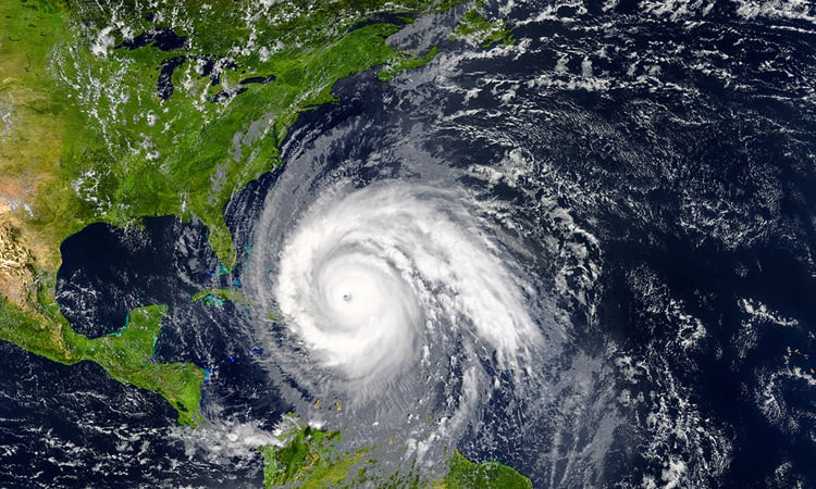
Hurricane Erin was downgraded to a Category 3 storm Sunday, but forecasters warn it is expected to intensify and grow in size in coming days, as it lashes Caribbean islands with heavy rains that could cause flash floods and landslides.
The first hurricane of what is expected to be a particularly intense Atlantic season, Erin briefly strengthened into a “catastrophic” Category 5 storm before its wind speeds weakened.
Forecasters do not currently expect it to make landfall along its expected course, but tropical storm warnings are in effect for the southeast Bahamas and Turks and Caicos Islands.
Hurricane Erin was located about 275 miles (445 kilometers) north of San Juan, Puerto Rico, at 5:00 pm Atlantic Standard Time (2100 GMT), with maximum sustained winds of 125 miles (205 kilometers) per hour, according to the Miami-based National Hurricane Center (NHC).
“The core of Erin is expected to pass to the east and northeast of the Turks and Caicos Islands and the southeastern Bahamas tonight and Monday,” the NHC said in their latest report.
The North Carolina Outer Banks, Bermuda and the central Bahamas were advised to monitor Erin’s progress.
Hurricane Erin had reached the highest level on the Saffir-Simpson scale just over 24 hours after becoming a Category 1 storm, a rapid intensification that scientists say has become more common due to global warming.বিস্তারিত